
How to Search Barboursville Property Records
A parcel inside village limits still records at the Cabell County level. Begin with the street address. Then confirm the municipal boundary and open the Assessor's map directory, where you must choose between the "01. Barboursville" and "02. Town of Barboursville" labels. Write down the district, map, parcel, and sub-parcel numbers. Those keys unlock both the Sheriff tax ticket search and the County Clerk deed index. Route permit and zoning questions to the village itself, because county property records will not answer them.
- Check the Barboursville boundary and locate the address in Cabell Assessor GIS or tax maps.
- Write down the full district-map-parcel-sub-parcel key and note which local map folder was used.
- Use the key in the Sheriff tax search and the owner or legal description in the County Clerk IDX.
- Compare the current GIS shape with a recorded plat or deed map where lot layout matters.
- Ask the Barboursville municipal office which permit or zoning records it holds; no verified public portal was found.
The Cabell property search guide walks through the full portal sequence for the county. For Barboursville, the extra step is telling village geography and map-series labels apart from a postal address.
Where Barboursville Property Records Are Kept
Deeds, liens, maps, and estate instruments all record with the Cabell County Clerk. The Assessor and GIS office supply the parcel and assessment context. The Sheriff Tax Office handles account and payment status. Barboursville keeps its own permit and zoning files. The village publishes no complete public municipal search portal. Its specific fields, fees, and coverage call for a direct question to village staff.
Cabell County Records
County offices hold deeds, tax tickets, assessment context, and parcel maps for Cabell land.
Barboursville Permits and Zoning
Contact the village office for permit, zoning, or code records.
Online fields and coverage were not confirmed in the official pages inspected.
Verify current contact details with the village.
Ask whether records are available for inspection or by request.
Barboursville Neighborhood and Subdivision Search Leads
No official source publishes a roster of Barboursville subdivision names, build eras, or map-book references. Local labels and geography clues can still point a search in the right direction. None of them counts as a recorded subdivision. Not until the Clerk map or deed is opened. For each candidate, record the exact plat name. Note the lot and block, recording date, book, and page. That detail lets a later search retrace the path.
| Neighborhood / Subdivision | Era | In the Records |
|---|---|---|
| Barboursville map folder | Folder date and subdivisions not established here | Assessor directory label “01. Barboursville”; verify parcel map and recorded plat. |
| Town of Barboursville map folder | Historic coverage requires map inspection | Separate directory label “02. Town of Barboursville”; not proof of a distinct modern boundary. |
| Village center and Merritts Creek approaches | Named plats and eras not verified | Research leads only; inspect Map Book and legal description. |
| Huntington Mall / commercial corridor | Exact commercial plats not located | Compare frontage tract, deed description, zoning, and parcel geometry. |
Use the map folder to find an assessment parcel. Then confirm the subdivision name and lot through the Clerk's Map Book, Deed with Map, or Surveyors Record Book. The Cabell parcel-map guide explains why tax maps and recorded plats serve different roles.
What Barboursville Property Records Can Show
County files can show a deed, assessment, tax ticket, or parcel-map reference for Barboursville land. Village files cover local permits and zoning. Each source proves a different fact. A tax-map label does not prove incorporation. An unpaid ticket does not prove a completed sale, and GIS never settles a surveyed boundary. For a binding answer, read the actual instrument and ask the office that holds the file.
Lawful use. Use Barboursville records for land research, property diligence, and civic review. Do not use a record or address to stalk, threaten, or harass anyone.
Barboursville Property Records Have Two Map-Directory Labels
The Cabell Assessor PDF directory lists "01. Barboursville" and "02. Town of Barboursville" as two separate folders. That split matters when an older deed, tax map, or address uses "Town" wording. Treat the labels as map-series clues only. They do not prove two separate legal municipalities for every record year. Open the relevant PDF and note the map date and parcel reference. Compare that against today's GIS and the County Clerk instrument. When a folder label and the current mailing city disagree, keep both names in your notes so the search can be repeated later. The Barboursville map folder sits in the Assessor directory.
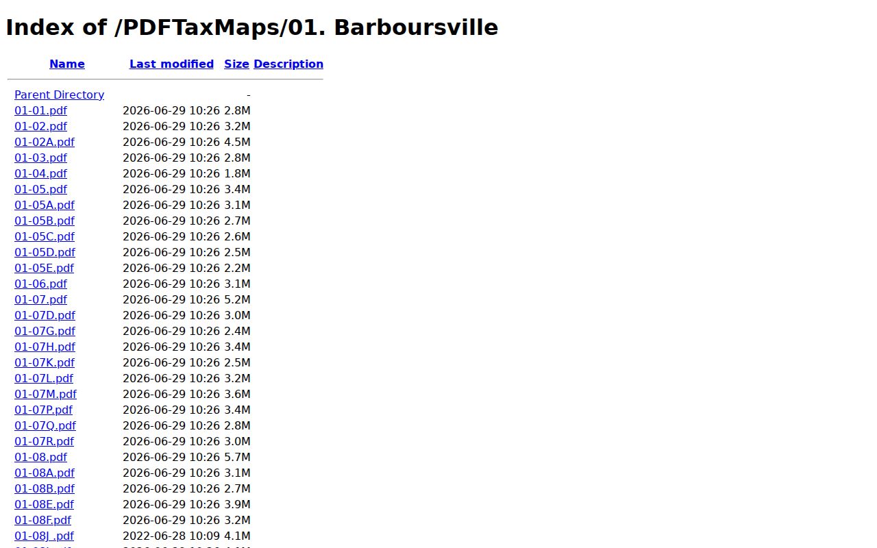
This folder identifies the map series for a parcel. Confirm any recorded lot or subdivision in the County Clerk map books.
Barboursville Property Records Cover Village and Commercial Corridors
The Huntington Mall corridor raises a different parcel question than a small residential lot. One retail mailing address or shopping-center name can span several tracts or tax parcels. Compare deed legal descriptions, map-book references, parcel geometry, and municipal jurisdiction. Do this before assuming a single property sits behind one business address. No exact named commercial plats or recording references are published here. Treat the mall corridor, the Merritts Creek approaches, and the Ohio River Road approaches as places to inspect. These are not verified subdivision names. The Clerk's recorded map and deed confirm the parcel boundary.
Barboursville Property Records Need a Village Boundary Check
A Barboursville address can sit near Huntington. It can also sit in rural Cabell County or on an unincorporated edge. The deed always records at the county level. Permit and zoning questions, though, turn on the municipal line. Check the parcel in County GIS. Then ask the village about its boundary before routing work records anywhere. No official incorporation or annexation ordinances with effective dates appear in the published sources. The "Town of Barboursville" map folder is not boundary evidence. A current boundary map and the recorded deed answer two different questions.
Barboursville Property Records Do Not Have a Verified Permit Portal
Barboursville offers no public online permit search with fields, years, fees, or record-request instructions. Identify the parcel first through county GIS and Assessor sources. Then ask the village which office maintains building, zoning, and code records. Ask as well how to inspect them. Never run a Barboursville property through Huntington's Tyler system. For a permit request, give the address and county parcel key. Ask whether the village requires a written records request. The lack of an online portal does not mean no municipal record exists. It only means access requires a direct question.
Barboursville Property Records Use ZIP and Tax Class Carefully
Barboursville’s main postal ZIP is 25504, but postal geography can stretch past the village limit. Treat the county GIS boundary and tax district as the real test, not the ZIP. The Assessor’s 2026 FAQ lists Barboursville Class 2 at 1.73020 and Class 4 at 3.46040; Class 2 means owner occupied, while Class 4 means non-owner occupied.
Those rates are year-specific. They say nothing about a sale price or market trend. Commercial parcels can carry different class and exemption details, so line up the actual assessment and tax ticket against the recorded deed. Confirm the current schedule with the Assessor before relying on any figure.