
How to Search Milton Property Records
For land around Milton, the records live with Cabell County rather than the town itself. A good first step is the property address or the Town of Milton map folder. Either one leads to the key you need: district, map, parcel, and sub-parcel numbers. That key unlocks the Sheriff tax search. The tax roll and current tax bill for the parcel appear there.
Deed records are a separate stop. The County Clerk IDX indexes deeds, map books, liens, estate instruments, and releases. Each of those instruments ties back to the parcel. GIS and plat maps show where the land sits. For local permits or zoning questions, contact Milton directly.
- Locate the property in County GIS or the “09. Town of Milton” PDF map folder.
- Write down the tax-map key and confirm the town or unincorporated boundary context.
- Search the Sheriff’s tax portal for the account or ticket and use the County Clerk IDX for deed history.
- Compare the current map with the recorded deed, Map Book, or Surveyors Record Book.
- Contact Milton for town permit and zoning files; the research did not confirm an online search system.
The countywide Cabell property-search route covers every shared portal. Milton’s distinctive clues are its Town of Milton map series, the town boundary, and local-history collections.
Where Milton Property Records Are Kept
The Cabell County Clerk serves as recorder, keeping deeds, map books, liens, estates, and releases. Parcel and value context comes from the Assessor and GIS. The Sheriff Tax Office handles ticket and payment status. Milton keeps its own municipal permit and zoning records. The town publishes no online portal, search fields, or copy instructions.
Cabell County Records
County offices hold the recorded deed and the tax-map, assessment, and ticket references for Milton land.
Town of Milton Permits and Zoning
Ask the Town of Milton which office holds the current permit and zoning files.
Online search fields, fees, and coverage were not confirmed.
Verify contact information directly with the Town.
Use the County GIS key when describing a property request.
Milton Neighborhood and Town-Lot Record Leads
No verified list of Milton subdivision plats exists on the official pages. It includes no dates and book references. The table therefore offers map and local-history leads rather than recorded subdivisions. Treat each named lot or plat as a lead only. Confirm it through the County Clerk Map Book, Deed with Map, or Surveyors Record Book. Then match the result to the current GIS parcel.
| Neighborhood / Subdivision | Era | In the Records |
|---|---|---|
| Town of Milton map series | Folder timestamp includes a Cabell 2022 map context | Assessor directory label “09. Town of Milton”; compare annual maps and Clerk description. |
| Older town-lot descriptions | Individual plat dates not verified | Search Map Book and deed-with-map types for lot/block references. |
| Ohio River valley addresses | Historic street eras not established in inspected pages | Use GIS boundary, tax district, historic directory, and recorded plat together. |
| Blenko and local-business history | Collection coverage varies by item | Research clue for street context, not proof of ownership or a subdivision. |
Once you find a plat, record its exact title, lot, book, and page. Use the current tax key to tie the historic parcel to a present map. The county parcel-map guide separates GIS reference lines from recorded plats.
What Milton Property Records Can and Cannot Prove
Milton property records can tie a parcel to its deed chain, tax classification, ticket, and mapped location, and town records may document a permit or zoning matter. Each source carries its own dates and jurisdiction. Keep their limits in mind. A mailing address does not establish the town line. A tax value is not a sale price, and a GIS outline is not a survey. For a formal ownership question, confirm with the County Clerk’s recorded instrument.
Lawful use. Use Milton records for property research, history, and due diligence. Do not use owner names or addresses to stalk, intimidate, or harass any person.
Milton Property Records Use the Town Map Series
The Assessor’s PDFTaxMaps directory includes a “09. Town of Milton” folder, alongside a Cabell 2022 map-folder timestamp and annual county maps through 2026. That locality series helps when an old deed uses town vocabulary. The current assessment card is not text-searchable. Confirm the map date. Compare the parcel with the County Clerk’s legal description. The annual series and the town folder serve different purposes. A folder’s timestamp does not prove every land value or boundary was updated that day. Use the current GIS and tax ticket for present parcel context. Use a recorded plat for lot history. Open the Town of Milton tax-map folder.
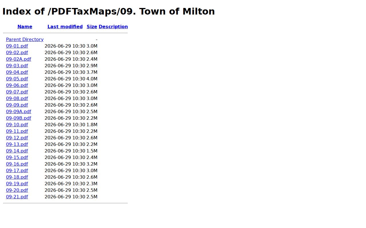
Think of the folder as an index into Milton’s local map series. Match its map references to the current parcel key and deed.
Milton Property Records Need a Town and Valley Boundary Check
Milton sits in Cabell’s western Ohio River valley and uses ZIP 25541. The county publishes no exhaustive ZIP edge map or town annexation history. A postal city can extend past the incorporated line. A permit question may belong to the Town or the county. So check the County GIS boundary and tax district. Older records may cite a town lot or road description. The description may no longer match a modern postal label. Preserve both versions of the address. Compare them with the map series, plat, and deed. The Town of Milton folder is a search clue, not a boundary determination.
Milton Property Records Reflect a Small Town Search Footprint
The 2020 Census incorporated-place table lists Milton's town population at 2,811. A town that size rewards careful source work. Older town-lot deeds often beat an assumed modern neighborhood name. Map books and directories can help too. Local-history collections round out the picture. The county's records remain the title source. Local context simply helps identify an old street or business reference.
The library's Milton materials include memorabilia, Garden Club and Woman's Club scrapbooks, and Blenko Glass material. Business and event photographs are also held there. Breece D'J Pancake material sits in the collections as well. Use those collections for community context, not to establish who held a parcel.
Milton Property Records Carry a Distinct Tax Rate Context
The Assessor FAQ lists 2026 Milton Class 2 at 1.60000 and Class 4 at 3.20000. Class 2 means owner occupied. Class 4 means non-owner occupied. West Virginia assessed value follows the 60% rule. The deed's consideration is separate from the tax bill. Before comparing Milton with Huntington or Barboursville, confirm the parcel class, homestead status, and tax district. These rates are year-specific and no market-value trend. A commercial or industrial parcel can carry a different class or exemption. Check the actual assessment and Sheriff ticket for the property.
Milton Property Records Need a Town Office Permit Check
The Town of Milton publishes no online permit or zoning portal. Huntington's Tyler system does not cover the town either. Start by pinning down the parcel. Use the county GIS map and the town's map series. Then call Milton. Ask which office keeps the building, zoning, and code records, and how you can inspect them in person.
A good request should include the site address. Include the county tax-map key if you have it. Ask whether staff can search by service address, permit number, or owner of record. Confirm any copy charge before ordering. The lack of a web portal is only an access gap. It does not mean a permit record fails to exist.
Milton Property Records Gain Context from Local Collections
Local collections can add real texture to a deed search. The Cabell County Public Library operates a Milton branch on Smith Street. Its special-collections survey lists Milton memorabilia and Garden Club and Woman's Club materials. It also holds Blenko Glass records, local business photographs, and work tied to writer Breece D'J Pancake. These items help explain a town name or business site. They can also clarify a historic street reference inside an old deed.
Library history supports the story, though. It is not a transfer record. For a former owner of record, work the County Clerk deed chain. The Archives books help there too. For a historic address, ask about directories or newspaper references and note the edition year.
Cabell County Public Library's local-history portal connects to genealogy and research services.
Use the portal to spot research collections. Then ask staff about Milton materials tied to a particular date or street.
Milton Property Records Can Reach Back Through County Books
Cabell deed books run from 1809 through 1901. The Archives deed index reaches from 1808 to 1968, with some letter segments missing for grantor and grantee names. When an older Milton chain stops at an index, try name variants, adjacent letters, and the original volume itself. The town's PDF plat series can help place a parcel description. County land books and the library add historical context.
Note down the book and page for every transfer. Compare each entry against current parcel identifiers. A modern address alone may not match the town or district wording used in the earlier deed.